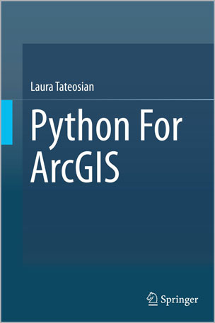
This book introduces Python scripting for geographic information science (GIS) workflow optimization using ArcGIS. It builds essential programming skills for automating GIS analysis. Over 200 sample Python scripts and 175 classroom-tested exercises reinforce the learning objectives. Readers will learn to: • Write and run Python in the ArcGIS Python Window, the PythonWin IDE, and the PyScripter IDE • Work with Python syntax and data types • Call ArcToolbox tools, batch process GIS datasets, and manipulate map documents using the arcpy package • Read and modify proprietary and ASCII text GIS data • Parse HTML web pages and KML datasets • Create Web pages and fetch GIS data from Web sources. • Build user-interfaces with the native Python file dialog toolkit or the ArcGIS Script tools and PyToolboxes Python for ArcGIS is designed as a primary textbook for advanced-level students in GIS. Researchers, government specialists and professionals working in GIS will also find this book useful asa reference.
Table of Contents
Chapter 1: Introduction
Chapter 2: Beginning Python
Chapter 3: Basic Data Types: Numbers and Strings
Chapter 4: Basic Data Types: Lists and Tuples
Chapter 5: ArcGIS and Python
Chapter 6: Calling Tools with Arcpy
Chapter 7: Getting User Input
Chapter 8: Controlling Flow
Chapter 9: Decision-Making and Describing Data
Chapter 10: Repetition: Looping for Geo processing
Chapter 11: Batch Geo processing
Chapter 12: Additional Looping Functions
Chapter 13: Debugging
Chapter 14: Error Handling
Chapter 15: User-Defined Functions
Chapter 16: User-Defined Modules
Chapter 17: Reading and Writing with Cursors
Chapter 18: Dictionaries
Chapter 19: Reading and Writing Text Files
Chapter 20: Working with HTML and KML
Chapter 21: Classes
Chapter 22: User Interfaces for File and Folder Selection
Chapter 23: ArcGIS Python GUls
Chapter 24: Mapping Module
About the Author
Laura G. Tateosian is a professor at the Center for Geospatial Analytics at North Carolina State University. She earned her B.A. in Mathematics from Towson University, her M.S. in Mathematics from the University of Oklahoma, and her Ph.D. in computer science from North Carolina State University. She has more than 8 years of experience teaching Python programming for GIS and receives outstanding teaching evaluations. In 2014, she received an award for her teaching at North Carolina State University. Her research involves geospatial data analysis, aesthetic geovisualization, eye-tracking for map and visualization design, and automatic narrative mapping with Python and ArcGIS. Her research has published in refereed conferences and journals, such as, Information Visualization, International Journal for Uncertainty Quantification, Transactions in GIS, ACM Transactions on Graphics, IEEE Transactions on Visualization and Computer Graphics, the proceedings of the International Symposium on Non-Photorealistic Animation and Rendering, the International Symposium on Applied Perception in Graphics and Visualization, and IEEE Computer Graphics & Applications (Visualization Viewpoints).



نقد و بررسیها
هنوز بررسیای ثبت نشده است.